


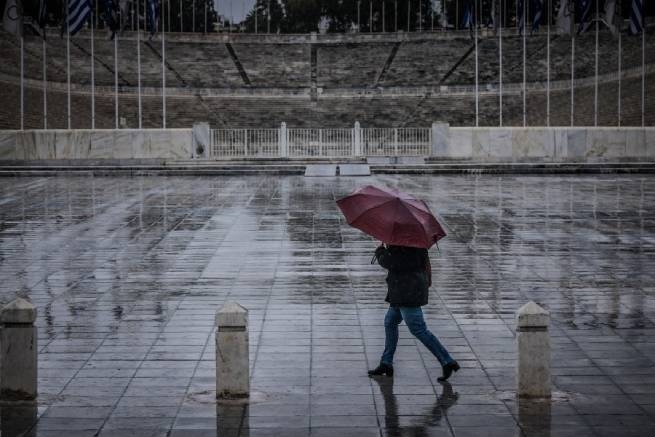
Heavy rainfall and thunderstorms expected on June 18 were issued by the National Meteorological Service in a special Bulletin of extreme weather events.
This Sunday will bring heavy rains and storms to the country, accompanied by frequent lightning and possibly hail. Mostly bad weather will affect the eastern part of Greece, extreme weather events are expected:
- at night and early in the morning in central Macedonia (especially in the region of Halkidiki and Pieria), as well as in the northernmost parts of Thessaly;
- before noon in eastern Thessaly and Sporades;
- from early morning to noon on Evia;
- from the middle of the day in Attica, Boeotia and temporarily in the northeast of the Peloponnese;
- with periodic breaks from morning to noon on the islands of the northern and eastern parts of the Aegean Sea, the northern Cyclades.
In the region of Magnesia, Sporades, central and northern Evia, phenomena will be strong and locally dangerous in the morning, and from noon they are expected in the rest of Evia, Attica and Boeotia.
Wind north / northwest force 4-5, at sea in some places up to 6 on the Beaufort scale. The temperature will not change significantly and in some places will reach 26-28°C.
ATTICA
Cloudy, rainy, occasional thunderstorms. The phenomena will be intense and dangerous in places from early morning until noon. Gradual weakening in the afternoon and better weather in the evening. Wind north/northwest, 3 to 5 on the Beaufort scale. Temperature 18-26°C.
THESSALONIKI
Cloudy with occasional rain and thunderstorms in the morning, gradual improvement in the weather. Wind north/northwest, 4 to 5 on the Beaufort scale. Temperature 18-26°C.
Yesterday we told how to Thessaloniki the storm hit again.
More Stories
Sharks in Greece began to appear in shallow waters more and more often
Covered the planet "extreme geomagnetic storm" (video)
Showers and storms throughout Greece