


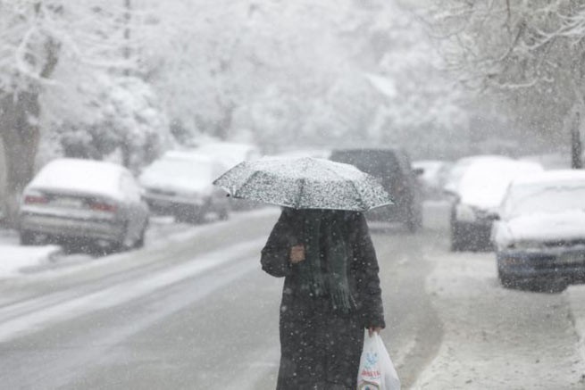
In the next 24 hours, a new cold wave is expected to invade Greece, which will bring snow, a significant drop in temperature, and gusty winds in the seas.
Bad weather is approaching
The severe weather is expected to make its presence felt on Sunday (28/1) at noon, with the worst weather expected to peak on Monday (29/1) and Tuesday (30/1).
“January is drawing to a close, and despite its sudden changes in temperature, from minus to plus 20, proving to us that this is the month of winter, the next few days will pass, bringing us another express snowfall, which, however, will locally demonstrate the intensity , something like a flash”writes Clearchos Marousakis in his Facebook post.
Snow will also be observed in the Attica prefecture, in the adjacent mountainous/semi-mountainous zone and at lower altitudes to the north. According to the meteorologist, although one would expect the snow to come from the north, in this case it will come from the sea, specifically through the Aegean Sea.
The cold may come to us from the north of north-eastern Europe, but if these polar air masses do not receive moisture from somewhere, they will remain dry, leading to the so-called “dry period”. Thus, the dry cold will affect the western and northern parts of the country, where the Pindos will act as a barrier and will not allow clouds and snow to move into these areas,” he explains.
He adds: “But further east, under the influence of the Aegean Sea, the cold will be accompanied by snow or snowfall depending on the altitude, as the cold air will be enriched with water vapor, leading to watery precipitation.” Areas that will experience snow and sleet:
- From the Pindos mountain range and further to the east, and from the heights of Chalkidiki and further to the south we will encounter strong north-easterly winds of force 7 to 8, intense cold and snow or snowfall.
- From the Pindos mountain range and further west and north of Halkidiki, dry frosts are expected with heavy frosts at night and in the morning, and long periods of sunshine. Light snowfall is possible towards Thrace. Frost is possible in places, which will mainly affect the northwestern part of the mainland.
Snow also in Attica
According to Clearhos Marousakis, snow will also be observed in the Attica prefecture in the adjacent mountainous semi-mountainous zone, as well as at lower altitudes in the northern areas, with an estimated height of about 300-400 meters and higher for the northern areas. The prefecture as a whole may experience some localized snowfall, especially in the evening and morning hours when cold transport will become more widespread, but this does not mean it will be accompanied by snowfall.
Tsatrafillias talks about “pan-Turkic” snow
In his message, George Tsatrafillias talks about a general Turkish snowfall that will affect the east of the country in a three-day period, from Sunday January 28 to Tuesday January 30, with the main features of a gradual decrease in temperature from 10 to 12 degrees, a gale north wind of 9 points on the Beaufort scale in the Aegean Sea and snowfall in the mountains/semi-mountains.
Although specific areas and altitudes cannot be determined at this time, Thessaly (mainly Magnesia-Larissa), Evia, Sporades, Boeotia, Phthiotis, Attica, northeastern Peloponnese and Crete may be affected.
Areas that will experience snow
Sakis Arnautoglou, referring to a new wave of bad weather, emphasizes that significant snowfalls are possible in Attica next Monday and Tuesday 29-30/1. He notes that, according to the latest forecast, snowfall is possible in the following areas:
Dionysos, Nea Penteli, Varnavas, Vilia, Kryoneri, Anixi, Afidnes, Drosia, Capandriti, Stamata, Thrakomakedones, Anthousa, Polidendri, Ekali, Fili, Nea Eritrea, Other, as well as Kifisia, Melisia, Pefki, Vrilisia, Grammatico, Agia Paraskevi , Likovrisi and Maroussi.
More Stories
Anniversary of the Greek tragedy – the 1999 earthquake (video)
Copernicus: Hottest Summer on Record
China braces for super typhoon "Yagi": schools closed, flights cancelled