


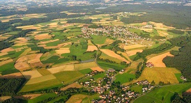
More than 10,000 localities across Greece are currently under urban quarantine.
As she told the publication “ΤΑ ΝΕΑ” urban surveyor Grammar Baklatsi, this happens after decisions State Councilwhich declared unconstitutional the delimitation and expansion of the boundaries of settlements carried out decisions of prefectsand this requires a Presidential Decree.
The issues raised by Ms. Baklatsi relate to settlements in the Rethymno and Volos area, but they also apply to other settlements throughout the country. For this reason, the Ministry of Environment and Energy is trying to find a solution to the urban planning problem of the development of the above-mentioned settlements.
“This leads to limited living space”
As Ms. Baklatsi notes, the Ministry of the Interior, due to the needs arising from climate change, is launching a new framework regarding the revision of the demarcation of settlements with new criteria for the boundaries that they must have. “This leads to limited living space,” she adds.
What does this mean in practice? Uncertainty regarding sales as the area currently included in the plan may be outside the plan. Edition “ΤΑ ΝΕΑ”with the help of questions 5 + 1 – answers, presents the new planning with all the upcoming changes, as well as which areas may be discovered at one time or another, on… the other side, i.e. outside the plan.
- What areas that were within the old boundaries of the settlement can now be located outside its boundaries and not be developed?
The old settlement boundaries included built-up areas that in some cases were considered unsuitable either because of geological landslides, because they were wooded areas, or because they were near streams, etc. For this reason, studies on the demarcation of new settlements will take into account all institutional lines, such as: forest maps, stream demarcations, coastlines, archaeological zones. So, areas unsuitable for construction are either excluded from the boundaries of settlements, or remain undeveloped, or can be designated as zones with development restrictions.
These areas to consider are:
- Forests and woodlands.
- Archaeological sites, historical sites, declared caves and any other protected areas or monuments.
- Nature protected areas.
- High productivity/priority 1 agricultural land zones, defined in accordance with current and applicable regulations, as well as irrigated areas based on an organized irrigation system.
- Any allocation – mixing areas provided for agricultural use.
- Coastal and beach areas in the presence of a structured development line on the coastline of coastal settlements.
- Existing public lands (riparian zone, etc.) in areas immediately adjacent to the coast or a navigable river or lake.
- Land expropriated or subject to expropriation in connection with the planned opening/expansion of national and provincial roads, railway lines, and areas of expropriation or easement of high and medium voltage transmission networks, the boundaries of which are fixed and certified by the competent authority.
- Zones that are geologically unsuitable for construction, as they will arise as a result of the preparation of a geological suitability study for settlements, the demarcation of which is being carried out for the first time.
- Watercourse zones. If there are undemarcated watercourses in the study area, a study of their temporary delimitation is compiled.
- Areas of other important natural features or other valuable landscapes that require special protection because they arise as a result of the preparation of an environmental report.
- Areas that are unsuitable for other reasons, for example areas with special requirements in matters of safety, hygiene, traffic.
What major changes are taking place?
Route:
- Exclusion from the limits of populated areas of lands built up in a zone of 250 meters around and along the perimeter of points where cemeteries are located.
- Additional studies that will provide specific guidance on stream delineation and flood line placement.
- What will be the general guidelines that determine which areas will be included in the city plan?
Data
A key element in the demarcation and construction of settlements with a population of less than 2,000 people is the latest census data ELSTAT 2021 (July 19, 2022). Also, to determine the polygonal boundary line delimiting the territory within the boundaries of the settlement, a number of data will be taken into account, such as:
- Time of creation of the settlement.
- Preservation at the same/original location, since some settlements (mostly mountainous) were moved/moved to another location.
- Cartographic (old topographic sketches or maps) or other evidence (for example, contracts), on the basis of which it can be concluded that the settlement existed as an independent residential complex with buildings (residential buildings, warehouses, etc.), as well as basic communal functions ( store). serving daily needs, church, school, square, etc.).
- Data from the settlement's 1920 census, as well as subsequent ESYE/ELSTA censuses to monitor the evolution of the settlement's population.
- Urban and spatial data and elements related to land morphology, structural integrity/composition of buildings and type of population density (low, medium or high).
- Elements of historical development and actions of the Administration that contributed to the creation of the “real” situation of a residential area, structured to this day with the urban planning regime of settlements before 1923.
- Existing acts of the Administration for determining the boundaries of a settlement with the rules in force at any time (file of the competent YMCA or other competent services).
- Aerial photographs, cartographic materials (GIS, cadastre, etc.) showing the settlement.
- Data, opinions and any relevant administrative acts of other competent services that manage areas subject to the same legal regime (forests, archaeological sites, traditional settlements, etc.) or protected natural areas (NATURA, etc.)
-
What about the demarcation of new settlements?
For newer settlements (after 1923), evidence has been collected to confirm the real situation that existed at the time of the publication of Law 1337/1983 or even the PD. 1985. This is due to the fact that the determination is not allowed to be made based on the actual situation that developed after the entry into force of this law, and it is also not allowed to redefine the boundaries of a settlement based on the new factual situation that developed after the initial demarcation, which implies an expansion of the original boundaries.
This procedure is allowed only in cases of correction of errors documented on the basis of actual data that were not taken into account during the initial delimitation. The content of the data should be traced, as far as possible, back to the period before 1985, from which it should be assumed that the settlement existed as an independent residential complex consisting of at least 10 buildings (residences, warehouses, etc.) or any other communal functions destination (store serving household needs, school, church, square, etc.), as well as beyond.
-
Is it possible to demarcate a new settlement whose borders are being introduced for the first time?
Yes it can be done. Either through an independent process (issuance of PD for settlement) or in the context of an ongoing TPS/EPS study. In this case, the settlement boundary proposal includes only one coherent part and two disconnected parts. Sparsely developed and undeveloped parts are included in urban development areas.
PS To the attention of those purchasing houses, villas or land plots for construction outside populated areas: by purchasing real estate in such areas, you risk that your plot may be outside the plan, which means that either construction there will be prohibited, or, even worse , your property may be demolished.
To avoid such problemsyou need advice with an independent lawyer. Because local lawyer maybe interested as a percentage of the sale and give you false information, which happens quite often.
More Stories
The issue of raising the retirement age is back on the agenda
Growth rates of private label sales in supermarkets
Moody's: Greek economic outlook upgraded to positive