


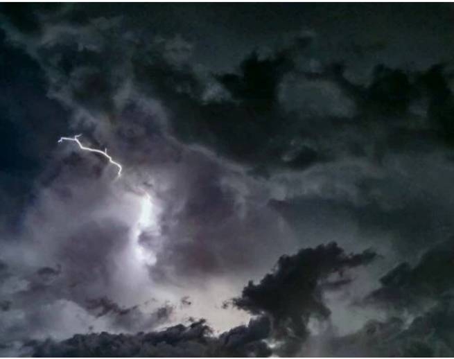
According to the National Observatory of Athens/meteo.gr, from yesterday evening January 19th until Monday January 23rd there is an emergency weather bulletin – heavy rains and storms are predicted, which at times will be accompanied by lightning, hail and strong winds.
EMY released emergency bulletin about bad weather. Heavy rain and thunderstorms are forecast:
- From Thursday evening 19-01-2023 in the northern Ionian Sea, Epirus, western Sterea and western Peloponnese until noon Friday 20-01-2023. Then the phenomena will temporarily weaken, and from Friday evening to Saturday their new strengthening from the west is predicted.
- From morning to Friday evening in central and eastern Macedonia and Thrace.
- From Friday afternoon until evening on the islands of the Eastern Aegean and the Dodecanese, and possibly temporarily in the Cyclades and Crete.
- Snowfall will occur in the mountains of Epirus, western Sterea and western Macedonia (estimated height 1000-1200 meters).
Saturday to Monday heavy rain and thunderstorms expected:
- early Saturday morning to evening in northern Ionia, Epirus, western Sterea and western Peloponnese, then again from Sunday evening to Monday afternoon.
- from Saturday noon to Sunday noon in central and eastern Macedonia, Thrace, the islands of the eastern Aegean and again from Monday noon to evening.
- snowfall in the highlands of Epirus, western Sterea and western Macedonia (estimated height 800 meters) during Saturday.
Since early Friday morning, the sky has “opened up” in the northern suburbs of Attica, it is raining in other areas, and the weather is reminiscent of winter in places. The weather change is related to the barometric low that is in the Balkan region and the approach of a new barometric low on Friday, which will then shift towards the Adriatic region. The main signs of bad weather will be precipitation over most of the country, snowfalls mainly in mountainous areas and a drop in temperature.
Heavy local rains and storms in the west from Thursday afternoon, and events are expected throughout the country on Friday night. The strongest will be in the Western continental part of Greece, in Eastern Macedonia and in the west of Thrace. Rain and short thunderstorms are expected in the eastern and western parts of the country on Friday afternoon. From Friday afternoon until Saturday morning, rain and thunderstorms will touch the west again, and on Sunday local precipitation is expected across the country.
Snowfall is expected from Thursday night to Friday until Sunday 22 January, mainly in the mountains of Pindos, Peloponnese and Macedonia, but also in the lower mountainous regions of Epirus and western parts of Macedonia.
From Thursday, temperatures will drop in the west, and from Friday in the rest of the country. On Friday, the maximum temperature is not expected to exceed 12-14°C, except for the Dodecanese and Crete, where it will reach 16-18°C in places.
The concentration of dust in the atmosphere is increased – on Friday in the eastern parts of the country, and on Saturday mainly in the Aegean Sea and Crete.
Today in Attica intensification of cloudiness with rain and thunderstorms in the morning and gradual weakening of phenomena from noon. Wind from the south, from 6 to 7 on the Beaufort scale, in some places in the east up to 8. From noon westerly wind, from 4 to 5 on the Beaufort scale. Temperature 9-17°C.
AT Thessaloniki cloudy, rain and thunderstorms, weakening phenomena since noon. Wind southeast, 5 to 6 on the Beaufort scale, southwest from noon. Temperature 9-15°C.
More Stories
Dolphins appeared in Thermaikos this morning
Most polluted countries in 2023: Greek regions with worst air quality
Clearchos Marousakis warns of hail and tornadoes (video)